.png)
Project Overview
Clean project snapshot for investors, partners, and service providers.
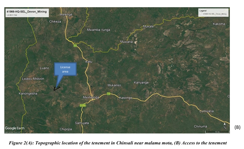
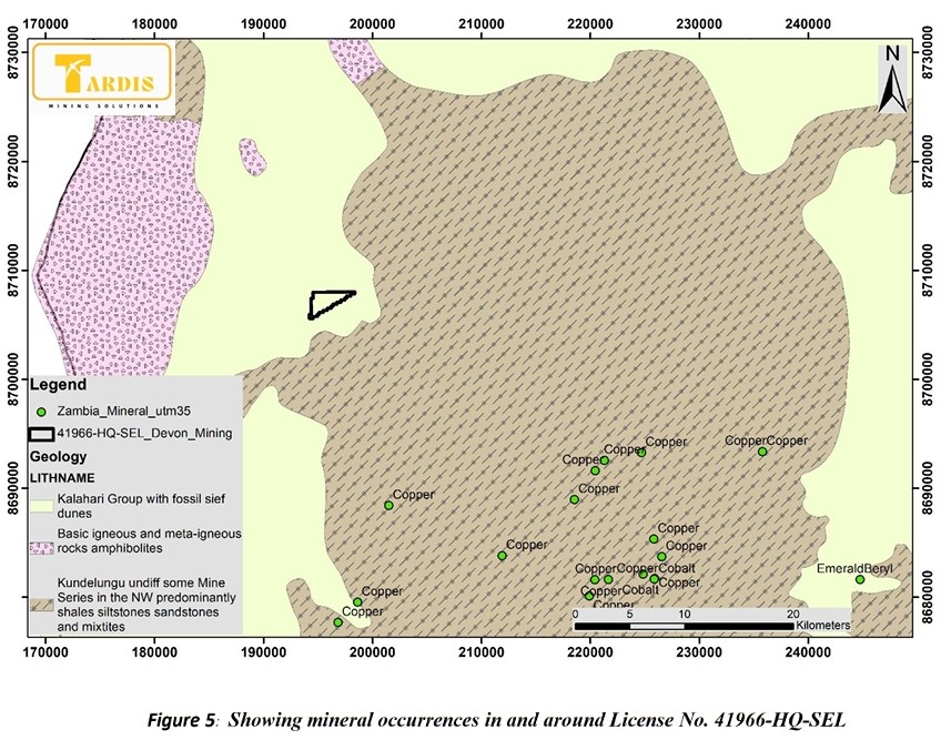
Devon Mining Limited holds Small-Scale Exploration Licence No. 41966-HQ-SEL in Mwinilunga District, North-Western Province, Zambia. The project is located within the Lufilian Arc, part of the Central African Copperbelt and a region known for significant copper and associated mineralisation. The licence targets cobalt, copper, gold, lead, silver and zinc.
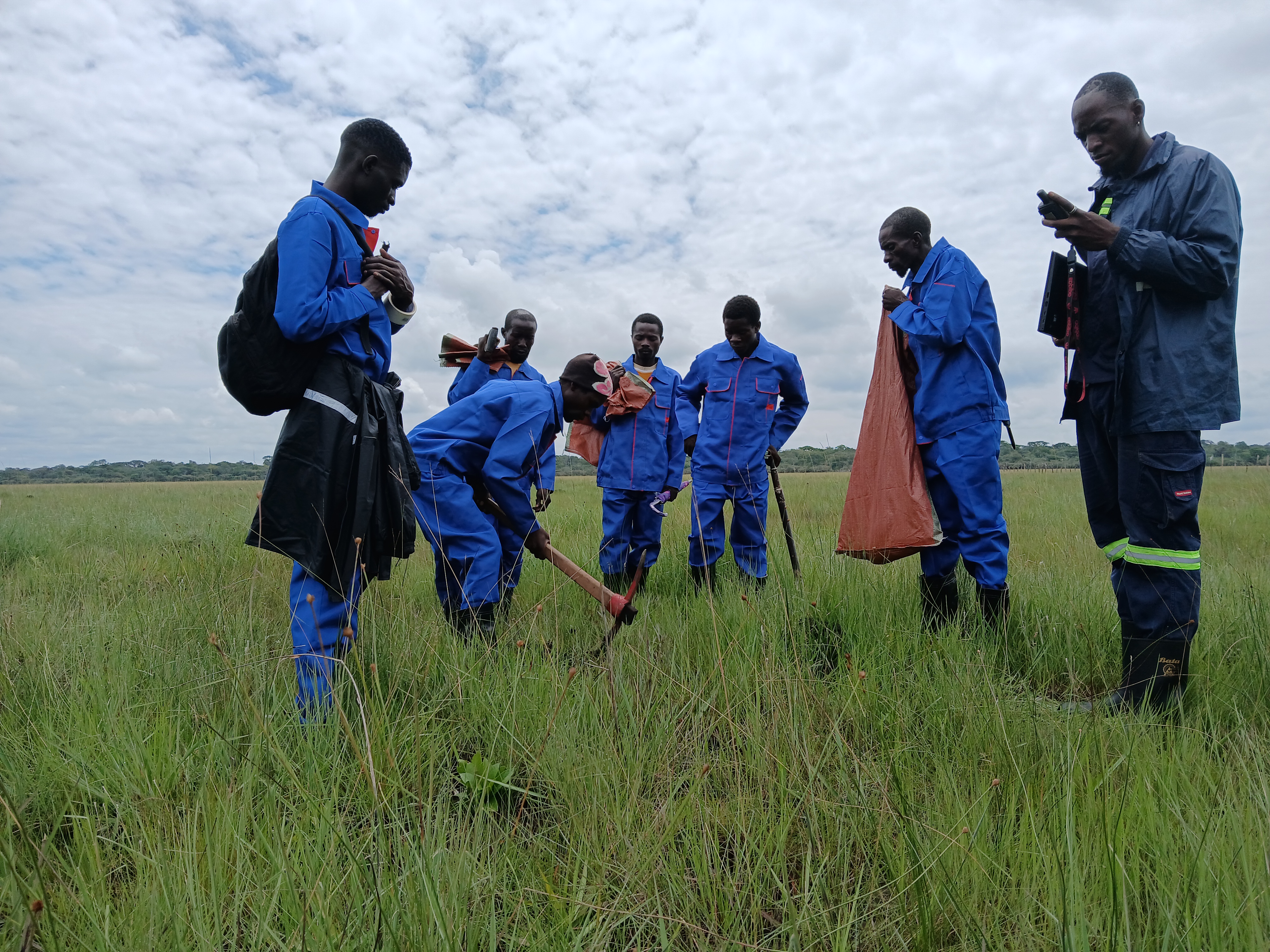
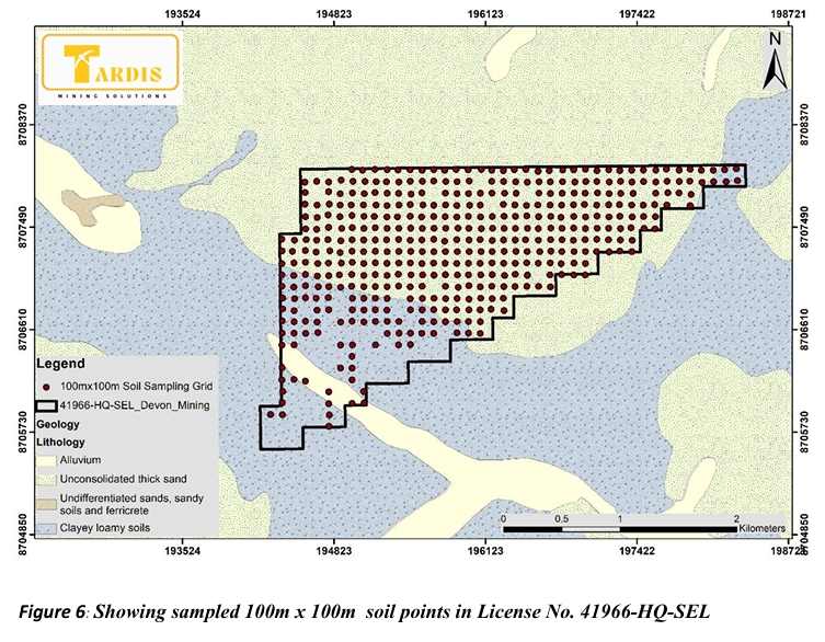
As part of its exploration programme, Devon Mining Limited undertook a systematic 100 m × 100 m soil geochemical survey, collecting 426 soil samples for analysis using portable X-ray fluorescence (pXRF). The licence area is affected by widespread Kalahari Sands cover, which can dilute and partially mask primary geochemical signatures at surface.
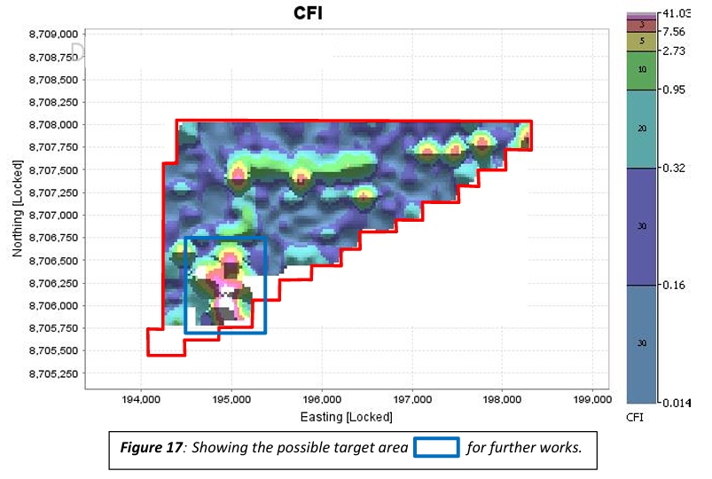
Interpretation of the survey results identified coherent copper-fertility anomalies beneath the sand cover. Ratio-based and multivariate analysis helped distinguish potentially meaningful copper enrichment from regolith-related effects, while associated arsenic anomalies provide a pathfinder indication for potential concealed gold mineralisation. The results have defined priority Cu-Au targets for follow-up exploration.
As part of its exploration programme, Devon Mining Limited undertook a systematic 100 m × 100 m soil geochemical survey, collecting 426 soil samples for analysis using portable X-ray fluorescence (pXRF). The licence area is affected by widespread Kalahari Sands cover, which can dilute and partially mask primary geochemical signatures at surface.
Interpretation of the survey results identified coherent copper-fertility anomalies beneath the sand cover. Ratio-based and multivariate analysis helped distinguish potentially meaningful copper enrichment from regolith-related effects, while associated arsenic anomalies provide a pathfinder indication for potential concealed gold mineralisation. The results have defined priority Cu-Au targets for follow-up exploration.